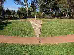
At a local botanic park students practice basic mapping and orienteering skills and explore the park and its wildlife. Their perceptions of how First Nations people might have used this place in times past are recorded as a story using Indigenous symbols.
Program details 
Venue: Peacehaven Botanic Park, Highfields
Student participation fee - see Booking Information
Duration: 4 hours
Program overview
The program overview provides:
a synopsis of the program
links to relevant parts of the Australian Curriculum
an indication of pedagogical strategies for the program's activities—based on Amaroo EEC's Pedagogical Framework (PDF, 198KB)
an outline of the teaching sequence.
Elements of the teaching sequence are colour-coded, showing which parts will be taught during the excursion by the Amaroo teacher/s and which should be covered by the classroom teacher (prior to or following the excursion) to fully cover the program's objectives. Suggestions are also given for relevant pre- or post-excursion activities and assessment tasks.
Program Overview (PDF, 607KB)
Curriculum Activity Risk Assessments (CARAs)
Because the activities associated with Amaroo's Mapping and Tracking program are rated at a low or medium inherent risk level, specific curriculum risk assessment documents for this program are not required. The risk assessment documents below have, however, been prepared by Amaroo staff if you would like to use them. They are partially completed (using the program and site knowledge of Amaroo staff), but relevant details concerning your school/visit should be added once you have downloaded them. Each CARA should be approved by your school principal and filed for your records.
Amaroo Risk Assessment - Mapping and Tracking Program (PDF, 334KB)